|
|
Norge - Norway - Noreg |
| |
Svalbard
- Glaciers |
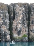
Nordaustlandet is the
second-largest island in the archipelago of Svalbard, Norway,
with an area of 14,443 square kilometres (5,576 sq mi). It lies
north east of Spitsbergen, separated by Hinlopenstretet. Much of
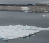
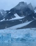
Nordaustlandet lies under large ice caps, mainly Austfonna and
Vestfonna, the remaining parts of the north being tundra
inhabited by reindeer and walruses. The island is uninhabited and
lies entirely within Nordaust-Svalbard Nature Reserve. English
walrus hunters first sighted the south point of Nordaustlandet in
1617. This discovery was shown on the Muscovy Company's map
(1625; but based on discoveries made in and prior to 1622), with
the island labeled as Sir Thomas Smyth's Island. It also shows
the North Cape (Point Purchas). It is first named Oostlandt
("East Land") on a Dutch map of 1662, and the following
year another Dutch map marked its coastline more distinctly,
showing its west and north coasts, separating the latter from the
Seven Islands (Sjuøyane). A Dutch map of 1710 was the first to
show the island accurately, naming it Het Noord Ooster Land
("The North-east Land").
You get a
larger picture when you click the thumbnails - usually showing
more that the small one
< Back to the index